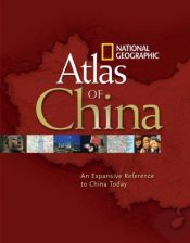
National Geographic Atlas of China
Blurb
Boasting more than 300 full-color maps and illustrations, this essential new atlas dramatically highlights the tremendous changes occurring within China—the world's fastest growing economy and most populous place—as well as their global implications. National Geographic maps the entire country with sections covering all provinces—including towns, cities, and transportation networks—to provide rich, comprehensive, and meticulously researched coverage of China's dynamic landscape.Ten major cities receive an entire spread with detailed maps and fact boxes. Coverage of Beijing, the capital, pinpoints sites of the 2008 Summer Olympics. And as Shanghai prepares to host the 2010 World's Fair—China's first, expected to draw 70 million visitors—this important destination is charted extensively as well.
Fascinating thematic maps accurately post the latest information on trade, energy, natural resources, population, military strength, religion, languages, tourism, transportation, and more. A substantial place-name index helps the reader navigate to thousands of specific locations. New satellite imagery—at the highest resolution ever published by National Geographic—reveals amazing details of China's diversified physical landscape. A historical timeline, commentaries, graphs, travel info, and photos complete the thorough yet succinct coverage of today's China.
For the millions of spectators planning to visit or view China's upcoming events... the many vacationers who tour the country each year... companies doing business with China... students of history and geography... and others interested in world events, this timely reference will prove indispensable.

 English
 Español
 Deutsch


Member Reviews Write your own review
Be the first person to review
Log in to comment